![](/images/other/stat-length.png)
![Trail On foot Gemeinde Willendorf - Vital Club Runde bei Willendorf - Photo](https://media.geolcdn.com/t/1900/400/fc8a1d28-8a84-486b-85da-d73bf9bbb863.jpeg&format=pjpeg&maxdim=2)
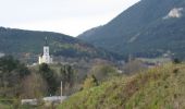
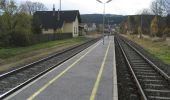
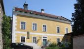
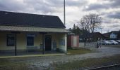
Vital Club Runde bei Willendorf
SityTrail - itinéraires balisés pédestres
Tous les sentiers balisés d’Europe GUIDE+
![Length](/images/other/stat-length.png)
Length
4.3 km
![Max alt](https://static1.geolcdn.com/siteimages/upload/files/1508320355ic_sort_altitude_max_24dp.png)
Max alt
574 m
![Uphill gradient](https://static1.geolcdn.com/siteimages/upload/files/1508320355ic_sort_den_pos_24dp.png)
Uphill gradient
190 m
![Km-Effort](/images/other/stat-length.png)
Km-Effort
6.8 km
![Min alt](https://static1.geolcdn.com/siteimages/upload/files/1508320355ic_sort_altitude_min_24dp.png)
Min alt
387 m
![Downhill gradient](https://static1.geolcdn.com/siteimages/upload/files/1508320355ic_sort_den_neg_24dp.png)
Downhill gradient
193 m
![Boucle](https://static1.geolcdn.com/siteimages/upload/files/16400158638029165_repeat_loop_refresh_sync_direction_icon.png)
Boucle
Yes
Signpost
Creation date :
2022-02-16 16:24:52.293
Updated on :
2022-03-03 07:58:05.921
![On foot](https://static1.geolcdn.com/sitytour/trail-icons/100.png)
1h33
Difficulty : Easy
![Scan this QR Code to open this trail in the SityTrail application](https://capi.geolives.com/qq0zvz2zws4bq2lad0pu/sitytour/trails/3127019/qr.png?size=200)
FREE GPS app for hiking
About
Trail On foot of 4.3 km to be discovered at Lower Austria, Bezirk Neunkirchen, Gemeinde Willendorf. This trail is proposed by SityTrail - itinéraires balisés pédestres.
Description
Trail created by Runnersfun.
Symbol: roter Pfeil
Positioning
Country:
Austria
Region :
Lower Austria
Department/Province :
Bezirk Neunkirchen
Municipality :
Gemeinde Willendorf
Location:
Unknown
Start:(Dec)
Start:(UTM)
578856 ; 5293608 (33T) N.
Comments
Trails nearby
![Trail On foot Gemeinde Würflach - Erlebnisweg Johannesbachklamm - Photo](https://media.geolcdn.com/t/375/260/e50695a8-ad92-4c43-b3d8-703a7530c6a4.jpeg&format=jpg&maxdim=2)
![On foot On foot](https://static1.geolcdn.com/sitytour/trail-icons/100.png)
Erlebnisweg Johannesbachklamm
On foot
Easy
Gemeinde Würflach,
Lower Austria,
Bezirk Neunkirchen,
Austria
![](/images/other/stat-length.png)
4.7 km | 7 km-effort
1h 35min
![](https://static1.geolcdn.com/siteimages/upload/files/16400158638029165_repeat_loop_refresh_sync_direction_icon.png)
No
![Trail On foot Gemeinde Würflach - Rundweg 4 - Photo](https://media.geolcdn.com/t/375/260/f79cf879-9ff5-4921-96db-7d2f52410a41.jpeg&format=jpg&maxdim=2)
![On foot On foot](https://static1.geolcdn.com/sitytour/trail-icons/100.png)
Rundweg 4
On foot
Easy
Gemeinde Würflach,
Lower Austria,
Bezirk Neunkirchen,
Austria
![](/images/other/stat-length.png)
4.9 km | 7 km-effort
1h 35min
![](https://static1.geolcdn.com/siteimages/upload/files/16400158638029165_repeat_loop_refresh_sync_direction_icon.png)
Yes
![Trail On foot Gemeinde Würflach - Würflach - Marterl Maria Drei Linden (Rundwanderweg) - Photo](https://media.geolcdn.com/t/375/260/f79cf879-9ff5-4921-96db-7d2f52410a41.jpeg&format=jpg&maxdim=2)
![On foot On foot](https://static1.geolcdn.com/sitytour/trail-icons/100.png)
Würflach - Marterl Maria Drei Linden (Rundwanderweg)
On foot
Easy
Gemeinde Würflach,
Lower Austria,
Bezirk Neunkirchen,
Austria
![](/images/other/stat-length.png)
4.5 km | 5 km-effort
1h 8min
![](https://static1.geolcdn.com/siteimages/upload/files/16400158638029165_repeat_loop_refresh_sync_direction_icon.png)
No
![Trail On foot Gemeinde Würflach - Orgelbau-Allgäuer Runde - Photo](https://media.geolcdn.com/t/375/260/1f55884a-f647-4c18-9034-94fc09c9018f.jpeg&format=jpg&maxdim=2)
![On foot On foot](https://static1.geolcdn.com/sitytour/trail-icons/100.png)
Orgelbau-Allgäuer Runde
On foot
Easy
Gemeinde Würflach,
Lower Austria,
Bezirk Neunkirchen,
Austria
![](/images/other/stat-length.png)
6.3 km | 7.3 km-effort
1h 39min
![](https://static1.geolcdn.com/siteimages/upload/files/16400158638029165_repeat_loop_refresh_sync_direction_icon.png)
No
![Trail On foot Gemeinde Würflach - 3 Linden Runde - Photo](https://media.geolcdn.com/t/375/260/1f55884a-f647-4c18-9034-94fc09c9018f.jpeg&format=jpg&maxdim=2)
![On foot On foot](https://static1.geolcdn.com/sitytour/trail-icons/100.png)
3 Linden Runde
On foot
Easy
Gemeinde Würflach,
Lower Austria,
Bezirk Neunkirchen,
Austria
![](/images/other/stat-length.png)
4.8 km | 5.6 km-effort
1h 16min
![](https://static1.geolcdn.com/siteimages/upload/files/16400158638029165_repeat_loop_refresh_sync_direction_icon.png)
No
![Trail On foot Gemeinde Höflein an der Hohen Wand - Erlebnisweg](https://media.geolcdn.com/t/375/260/960fe85b-3cef-48ec-a010-b76d552f7441.jpeg&format=jpg&maxdim=2)
![On foot On foot](https://static1.geolcdn.com/sitytour/trail-icons/100.png)
Erlebnisweg "Mit allen Sinnen genießen"
On foot
Easy
Gemeinde Höflein an der Hohen Wand,
Lower Austria,
Bezirk Neunkirchen,
Austria
![](/images/other/stat-length.png)
9.2 km | 12.7 km-effort
2h 53min
![](https://static1.geolcdn.com/siteimages/upload/files/16400158638029165_repeat_loop_refresh_sync_direction_icon.png)
Yes
![Trail On foot Gemeinde Schrattenbach - tut gut Route 4: Grablinger Tour - Photo](https://media.geolcdn.com/t/375/260/3fc821f4-3807-4c5d-bfdb-e02d2ef77d63.jpeg&format=jpg&maxdim=2)
![On foot On foot](https://static1.geolcdn.com/sitytour/trail-icons/100.png)
tut gut Route 4: Grablinger Tour
On foot
Medium
Gemeinde Schrattenbach,
Lower Austria,
Bezirk Neunkirchen,
Austria
![](/images/other/stat-length.png)
13.9 km | 21 km-effort
4h 40min
![](https://static1.geolcdn.com/siteimages/upload/files/16400158638029165_repeat_loop_refresh_sync_direction_icon.png)
Yes
![Trail On foot Gemeinde Grünbach am Schneeberg - Gründbach Freibad - Hornungstal - Adriganhof (Hornungstal) - Füllenhalskreuz (Anschluß WWW06) - Photo](https://media.geolcdn.com/t/375/260/8244c04f-8837-4ae4-9362-ca8594d0ce44.jpeg&format=jpg&maxdim=2)
![On foot On foot](https://static1.geolcdn.com/sitytour/trail-icons/100.png)
Gründbach Freibad - Hornungstal - Adriganhof (Hornungstal) - Füllenhalskreuz ...
On foot
Easy
Gemeinde Grünbach am Schneeberg,
Lower Austria,
Bezirk Neunkirchen,
Austria
![](/images/other/stat-length.png)
4.5 km | 7.7 km-effort
1h 45min
![](https://static1.geolcdn.com/siteimages/upload/files/16400158638029165_repeat_loop_refresh_sync_direction_icon.png)
No
![Trail On foot Gemeinde Winzendorf-Muthmannsdorf - Jubiläumssteig - Photo](https://media.geolcdn.com/t/375/260/a5810265-f554-4ad8-8163-be4e061eeeb1.jpeg&format=jpg&maxdim=2)
![On foot On foot](https://static1.geolcdn.com/sitytour/trail-icons/100.png)
Jubiläumssteig
On foot
Easy
Gemeinde Winzendorf-Muthmannsdorf,
Lower Austria,
Bezirk Wiener Neustadt,
Austria
![](/images/other/stat-length.png)
3.5 km | 4.9 km-effort
1h 7min
![](https://static1.geolcdn.com/siteimages/upload/files/16400158638029165_repeat_loop_refresh_sync_direction_icon.png)
Yes